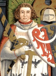
t is widely believed that the Rogowiec castle was erected by the Świdnica-Jawor prince
Bolko I (d. 1301) to consolidate the supreme power in the area and to protect the southern border of his principality. It should also be mentioned that in the vicinity of the castle, along the valley of the Rybna River, a trade route from Świdnica to city of Nachod led in the Middle Ages. Its mountainous section passed through the Wałbrzyskie and Owl Mountains, and further through the Dry Mountains via the Three Valleys Pass to Mieroszów, so we can assume with a high degree of probability that the castles standing in its vicinity (Grodno, Radosno, Rogowiec) also served to secure or even control traffic on this route. One of documents of the Cistercian monastery in Krzeszów preserves a record dated September 8, 1292, which lists Reinsko Schwenckenfeldt as Hornberch Castellanus. This is the oldest known historical reference to Rogowiec castle.
RUINS OF ROGOWIEC, L. RICHTER'S INTAGLIO FROM THE 1840S
I
n 1353 Prince
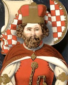
Bolko II of Świdnica (d. 1368) bequeathed the castle to his niece Anna of Świdnica (d. 1362), wife of Czech King
Charles IV (d. 1378). On her behalf, the castle was managed by ducal courtiers, among others, in 1361-1374 the burgrave of Rogowiec was the ducal steward Nicolaus de Bolcze. In 1392, after the death of Bolko\'s widow, Duchess Agnes Habsburg, the castle passed under Czech rule and lost its strategic significance. It was soon given as a fief to knightly families.
F. VOGEL'S DRAWING FROM 1850
A
ccording to tradition, during the Hussite wars troops of Bohemian Taborites captured and devastated the castle. In the second half of the 15th century, it belonged, among others, to Franz von Pogarell and brothers Hans and Nikolaus Schellendorf, owners of Książ and Radosno castles, who became "famous" for bandit raids and attacks on merchant convoys. In the hands of the Schellendorfs, Rogowiec remained until its fall in 1482 (or 1497), when it surrendered to royal troops led by Georg von Stein (d. 1497). It is possible that firearms were used to capture the castle at that time, as indicated by fragments of cannonballs and a falcon discovered during archaeological excavations. From the 16th century, the surrounding estate, including the castle, belonged to the Hochbergs, who acquired it from King
Vladislav II Jagellonský for 600,000 Czech groschen.
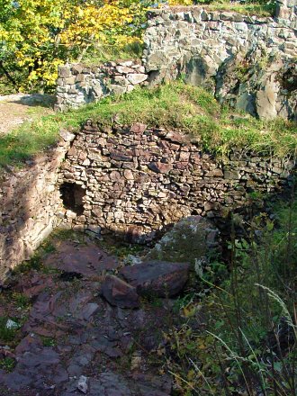
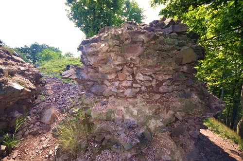
he castle was built of stone, on a rocky hill with an altitude of 870 meters above sea level. The oldest part of it is the upper castle having a plan similar to a triangle with sides of 20x30 meters. The dominant feature here was a cylindrical tower of the last defense with a diameter of about 10 meters and a thickness of walls reaching 3.5 meters. Residential functions were served by a two-winged building on a rectangular plan measuring 10x17 meters, based on the eastern curtain.
FOUNDATIONS OF RESIDENTIAL BUILDING
I
n the 14th century, the eastern building was demolished and a larger edifice with a base size of 7x15 meters was erected in its place. Around the same time, two towers and a gate tower were built on the hillside, connected by an earthen rampart. The last phase of the stronghold's development presumably took place in the mid-15th century and included an erection of a residential tower on the upper castle, an enlargement of the gate tower and an expansion of the outer fortifications.
mong relics of the castle we can distinguish
foundations of a dwelling house,
fragments of the perimeter wall, faint relics of towers and
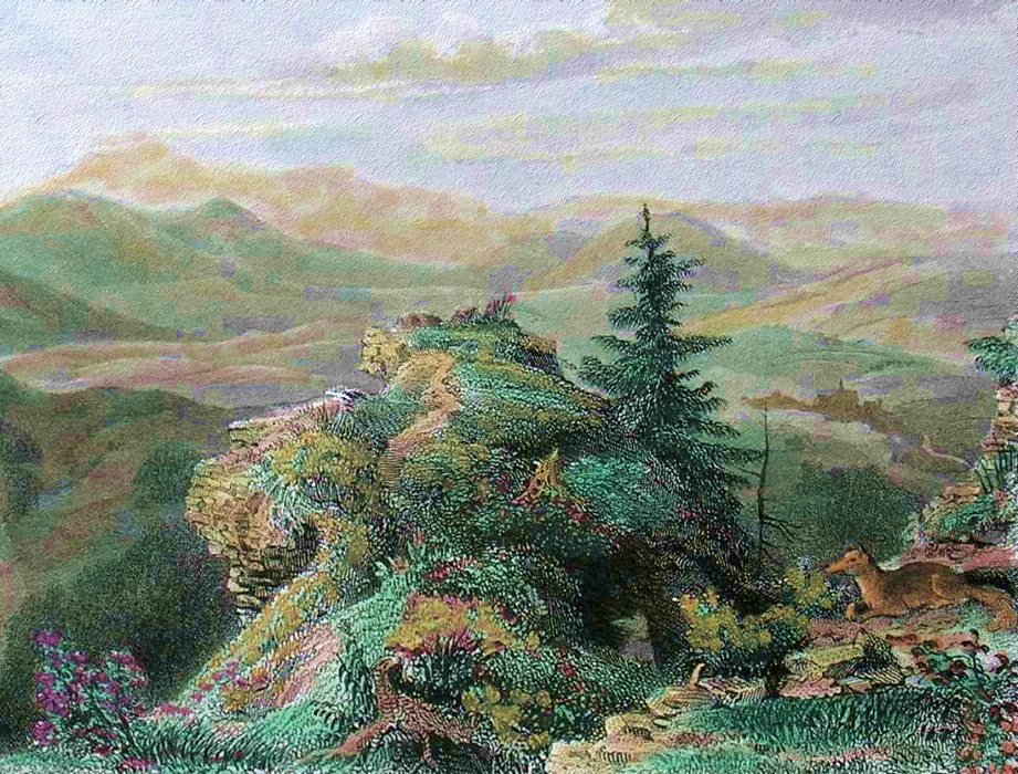
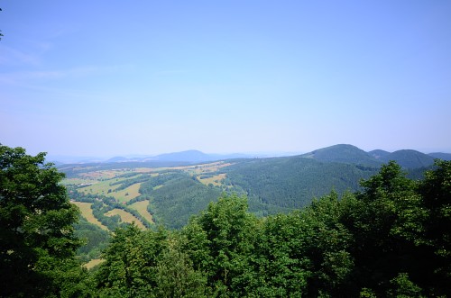
lower parts of the cylindrical tower up to 3 meters high. The ruin looks quite modest, but in this case the special magic of the place is created not by the castle, but by its location - as Rogowiec is the highest located medieval stronghold in Poland offering exquisite Sudeten scenery. From the top of the mountain (870 meters above sea level) there is a
beautiful panorama of the Wałbrzyskie Mountains to the north, the picturesque surroundings of Unisław Śląski to the west, and a view of the Sowie Mountains, located to the east of Rogowiec.
ON TOP OF ROGOWIEC MOUNTAIN
Free admission
I recommend a trip to the castle only for those dogs who like long and strenuous walks.
The place is friendly for taking aerial photography.
GETTING THERE
R
ogowiec is located on a narrow forested mountain isthmus rising steeply above the valley of the River Rybna separating the Wałbrzyskie Mountains from the Stone Mountains, about 1.5 km west of Grzmiąca village. There are several alternative ways to get there and enjoy a pleasant walk. The yellow trail leads from Wałbrzych to the blue trail on the Kozia Pass. It is an easy road, also suitable for mountain bikes, except for a long, steep descent into the Rybna valley. Time of the walk: about 2.5 hours. From Jedlina Zdrój the red trail leads, also mild, in the final climb it connects with the blue trail and from this point the difficulty level increases slightly. About 3 km west of the castle there is a popular hostel called Andrzejówka (800 meters above sea level) - there is a blue, red and yellow trail leading from there. This is definitely the easiest and most popular road, because Andrzejówka can be reached by car, and then within two-three hours You can visit the ruins and return.
BIBLIOGRAPHY
1. M. Chorowska: Rezydencje średniowieczne na Śląsku, OFPWW 2003
2. L. Kajzer, J. Salm, S. Kołodziejski: Leksykon zamków w Polsce, Arkady 2001
3. J. Lamparska: Zamkowe tajemnice, Asia-Press 2009
4. R. Łuczyński: Chronologia dziejów Dolnego Śląska, Atut 2006
VIEW FROM ROGOWIEC ON THE LANDSCAPE PARK "SUDETY WALBRZYSKIE"
Castles nearby: Rybnica Leśna - ruins of Radosno castle from the 14th century, 4 km Wałbrzych - remains of Nowy Dwór castle from the 14th century, 10 km Zagórze Śląskie - ruins of a ducal castle Grodno from the 14th-16th centuries, 15 km Grzędy - remains of Konradów castle from the 14th century, 20 km